Fantasy Races by Chense - In Work: Giro d´Ossola

Moderators: systemmods, Calendarmods

Post Reply
Chense
Posts: 504
Joined: Fri Mar 05, 2010 8:18 pm
Contact:

Fantasy Races by Chense - In Work: Giro d´Ossola

Post by Chense » Sat Jun 09, 2012 5:40 pm

As i cannot delete whats in my old Topic i started a new one for my newest project:
The Tour of Styria - A 7 day tour all around the beautiful green hart of austria.

Tour of Styria: Leoben-Lachtal

A Stage all around the beautiful green heart of Austria with Stages for every kind of rider which was designed to give honor to my new homecountry.

Important Facts:

Number of Stages: 7
Number of Restdays: 0
Total Length: 1119km (1090km without ITT)
Length per Stage: 160km (181km without ITT)
Flat Stages: 2
Medium Mountain Stages: 2
Mountain Stages: 2
ITT: 1


The Stages:

1. Stage: Leoben to Graz - 178km - 2094hm

A quite easy stage that should be for the sprintteams if they work together heading vom Leoben over Kapfenberg towards the Stuhleck-Mountainroad and then down again over Weiz to Graz.

Image

Intermediate Sprint 1 at KM 62 - Mürzzuschlag
GPM 2nd Category (11km, 550hm, 4,9%) at KM 83 - Stuhleck Mountainroad
Intermediate Sprint 2 at KM 118 - Birkfeld
GPM 4th Category (2km, 110hm, 5,5%) at KM 148 - Jassingberg

Mintact at KM 147

2. Stage: Köflach to Fürstenfeld - 185km - 2045hm

A stage were the sprinter teams should have an easy win. The route goes from Koeflach via Mureck back up to Fürstenfeld over quite flat terrain.

Image

GPM 4th Category (5KM, 220hm, 4,4%) at KM 21 - Gundersdorf
GPM 4th Category (2km, 110hm, 5,5%) at KM 80 - Glanz an der Weinstrasse
Intermediate Sprint 1 at KM 109 - Mureck

Mintact at KM 174

3. Stage: Graz to Bürgeralpe - 182km - 3144 hm

The first more hilly stage on the route which should prove to be a secure win for classic riders or classicsprinter teams. From Graz over Deutschfeistritz and Kapfenberg to Mariazell with a finish on the Bürgeralpe.

Image

GPM 4th Category (3km, 130hm, 4,7%) at KM 52 - Södingberg
Intermediate Sprint 1 at KM 82 - Deutschfeistritz
Intermediate Sprint 2 at KM 125 - Kapfenberg
GPM 3rd Category (4km, 290hm, 7,4%) at KM 158 - Seewiesen

Mintact at KM 155

4. Stage: ITT Wörschach to Donnersbachwald - 29km - 501hm

A medium hard ITT starting pretty flat and getting a bit steeper in the End.

Image

5. Stage: Mariazell to Bad Aussee - 188km - 3217 hm

Another pretty hilly stage that could be one for Classic Riders or a perfect hillsprintersteam. The route goes from Mariazell to Liezen over the Hengst and Pyhrnpass and then ends up by running throughout the "Ausseerland".

Image

Intermediate Sprint 1 at KM 23 - Weichselboden
Intermediate Sprint 2 at KM 61 - Gams
GPM 4th Category (2km, 140hm, 7%) at KM 64
GPM 4th Category (5km, 200hm, 4%) at KM 107 - Hengstpass
GPM 3rd Category (4km, 250hm, 6,2%) at KM 131 - Pyhrnpass
GPM 4th Category (1km, 100hm, 10%) at KM 179 - Prietal

Mintact at KM 175

6. Stage: Scheifling to Radstadt - 184km - 3818hm

After a transfer over to Scheifling the riders will have to face a stage thats anywhere in between really high mountain and medium mountain stages but classified as H.C. Stage. This stage the only one leaving Styria in the hole tour consists climbs over Hochrindlpass, Turracher Höhe and Radstädter Tauern as a warmup for the big final.

Image

GPM 4th Category (6km, 200hm, 3,3%) at KM 6 - Mariahof
Intermediate Sprint 1 at KM 28 - Friesach
Intermediate Sprint 2 at KM 57 - Weitensfeld im Gurktal
GPM 1st Category (9km, 700hm, 7,8%) at KM 85 - Hochrindlpass
GPM 1st Category (7km, 670hm, 9,6%) at KM 102 - Turracher Höhe
GPM 2nd Category (7km, 450hm, 6,4%) at KM 164 - Radstädter Tauern

Mintact at KM 156

7. Stage: Judenburg to Lachtal - 178km - 4457hm

Definitively the "Kings" Stage of this tour. Judenburg to Lachtal that seems so near (only 30km on the shortest way) but the race organisation to decided to set a route via Triebener Tauern and Sölkpass, then via small roads throughout the Salchau up to Lachtal where the route finishes on the top of Great Zinken.

Image

GPM 4th Category (3km, 110hm, 3,66%) at KM 36 - Triebener Tauern
Intermediate Sprint at KM 69 - Liezen
GPM 1st Category (11km, 680hm, 6,2%) at KM 139 - Sölkpass
GPM 3rd Category (3km, 210hm, 7%) at KM 152 - Kammersberg
GPM Hors Categorie (18km, 1320hm, 7,3%) at KM 178 - Zinken

Mintact at KM 149

------

I hope you like this tour! Next project: Series of Onedayraces all around Austria!

Chense
Posts: 504
Joined: Fri Mar 05, 2010 8:18 pm
Contact:

Re: Fantasy Races by Chense - In Work: Giro d´Ossola

Post by Chense » Sat Jun 09, 2012 7:22 pm

Before i go for the series of one day races i want to finish one old project of mine - ATTENTION! Big problems with the editor for this race because its to steep so i will have to overwork it all and finishing it will take some longer.

As i planned my summer holidays in the Val d´Ossola (Domodossala near Lago Maggiore) I just thougt for fun about visiting Punta Indren per pedes from the Swiss side in fact I already knew it would be to hard for me ... but it was good as I got the idea to create a extreme tour in the Alps thats just conceptionell ... it does not have the aim to be ever ridden.
As I am a great skiing fan the route is very influenced by actual and historical skiing resorts to be found in the Val D´Ossola what is in fact also the reason to have my summer holidays there (No not skiing - But wandering and visiting some of the now abandoned skiing resorts)
The 4th stage is the only one not influenced by a Ski Resort so the stages are also named after those and the Stage-Description will also give you some information about the naming skiing areas

Giro D´Ossola

Important Facts
Number of Stages: 5
Number of Restdays: 0
Total Length: 753 km (727km without TT)
Length per stage: 150,6 km (181,75 without TT)
Total Ascent: 25097hm (5019,4 with MTT)
Flat Stages: 0
Easy Mountain Stages: 1
Medium Mountain Stages: 0
Hard Mountain: 3
Mountain Time Trial: 1
Visited Countries: Italia - Swiss


The Stages

1a tappa: Rossareccio - Hard Mountain - 201km - 5696hm

Image
The first stage is not easy ... but it is easy compared to the stages to come. It starts in Domodossola the main town of the Val d´Ossola from there it first goes south to the little town of Macugnaga where the first mountain of the day waits ... the smaller one of Macugnagas House Mountains - The Belvedere which also has a little skiing resort with 2 chairlifts. From here you can also see the old skiing resort of macugnaga Rossareccio (2067m) which has been partly destroyed by a great avalanche in the 80s(? if someone knows better tell me just said it from memory didnt find it anywhere)and never been built up again. After reaching the summit the riders will downhill on a partly same road back to the mainstreet of the Val d´Ossola and north until we reach Riale in the head of the valley - from there it goes up on some roads that are dirt roads but good to ride to the pass height set on the frontier between Swiss and Italy ... riding down along the Lago Bianco and Lago Robej into the Val del Sambuco passing the to Maggia-Hydropowerplants and back up the little skiing station of San Carlo

2a tappa: Monte Moro - Hard Mountain - 150km - 4761hm
The second stage starts in Verbania the Capital of the Italian Province Verbano - Cusio - Ossola situated on the lago del maggiore from there the riders follow the Strada del Sempione (Simplon-Street) once more to Domodossola and from there not as in the first stage to the north but just up the Simplon-Pass over Brig to Visp from where the road to Monte Moro starts - First through the 3 Saases slowly up (Saas-Grund, Saas-Almagell, Saas-Fee) to the Mattmark Lake where a powerplant stays and then again on dirt roads up the last km over the frontier where the last 300hm are going through the trasses of the old swiss glacier lifts to the finish in 2757m just 150m under the summit of Monte Moro which was specially known for the Summer Skiing Resort (not situated on the glacier!) on the frontier between swiss and italy which had to close in the late 80s due to snow problems and differences between swiss and italy. Today it is still famous for the pista Mecchia down to Alpe Bill just 300m over Macugnaga - 2 times chosen as one of the 10 most beautiful slopes in Italy. Another interesting fact is, that most of the lifts are built by some factories that don´t exist anymore but are famous for buldings lifts like Ceretti Tanfani and Marchisio, but especially the Funivia Macugnaga - Alpe Bill with only 15 places built in 1959 is a technical milestone and what makes it even more interesting it has been built by the famous Funivie Piemonte which also invented the ovovia (Picture in the end)

3a tappa: Dia Viar Päss - Hard Mountain - 122km - 4960hm
Okay this stage stays a little quiz until I present it as it is the only one not connected to a Ski-Area in or around the Val D´Ossola.
There is one possibility in Switzerland to go over 4 passes in just 122km - Which passes are meant?

REST DAY

4a tappa: Bontadini - Hard Mountain - 254km - 7300hm
The finish is near ... the stages get harder and harder - After a transfer on the Rest day the riders start from Martigny into their race over 3 passes.
First its going south over the St.Bernhard already known from the Tour de France. After a downhill the route is going to Aosta and from there always following the A5 (Autostrada Aoasta) until we reach Chatillon ... then up over a first hill to Champoluc and then upwards through the skiing resort of Champoluc - Gressoney which has not been my inspiration (paaaah the area that kills Punta Indren can´t be an Inspiration) down to Gresonney out of the valley and over to Cervinia the italian side of Zermatt skiing resort but there the route has not ended ... the riders go up the only a few times a year opened road to Bontadini (Theodulpass) which is the highest point in the alps to be legally reached by car. The skiing resort of Zermatt beautifully situated between Matterhorn, Monte Rosa, Dent Blanche and different other mountains higher than 4000m is with 313km of slope in total (Zermatt + Cervinia) one of the biggest and best known skiing resorts in the alps.
The Theodulpass where the stage ends has already been used by the romans.

5a tappa: Punta Indren - Mountain Time Trial - 26km - 2380hm
This last stage will be the real decider ... a hilarious MTT
Now first the bad news ... we tried to reach the 4000m by going the normal eastern route but it had been to steep for RSF (21,3% avg) so we had to go via the west route where the highest point is just 3984m high ... so unlucky there :-) Well the route goes from Zermatt over dirt roads through the Zermatt skiing resort up the Grenzgletscher where some great engineers have built a rideable road through the everlasting ice ... reaching nearly 4000m we are going back to Italy and down around 800hm near to Punta Indren which had one of the first summer skiing areas in Italy (On the Indren Glacier Late 60s - Late 90s).
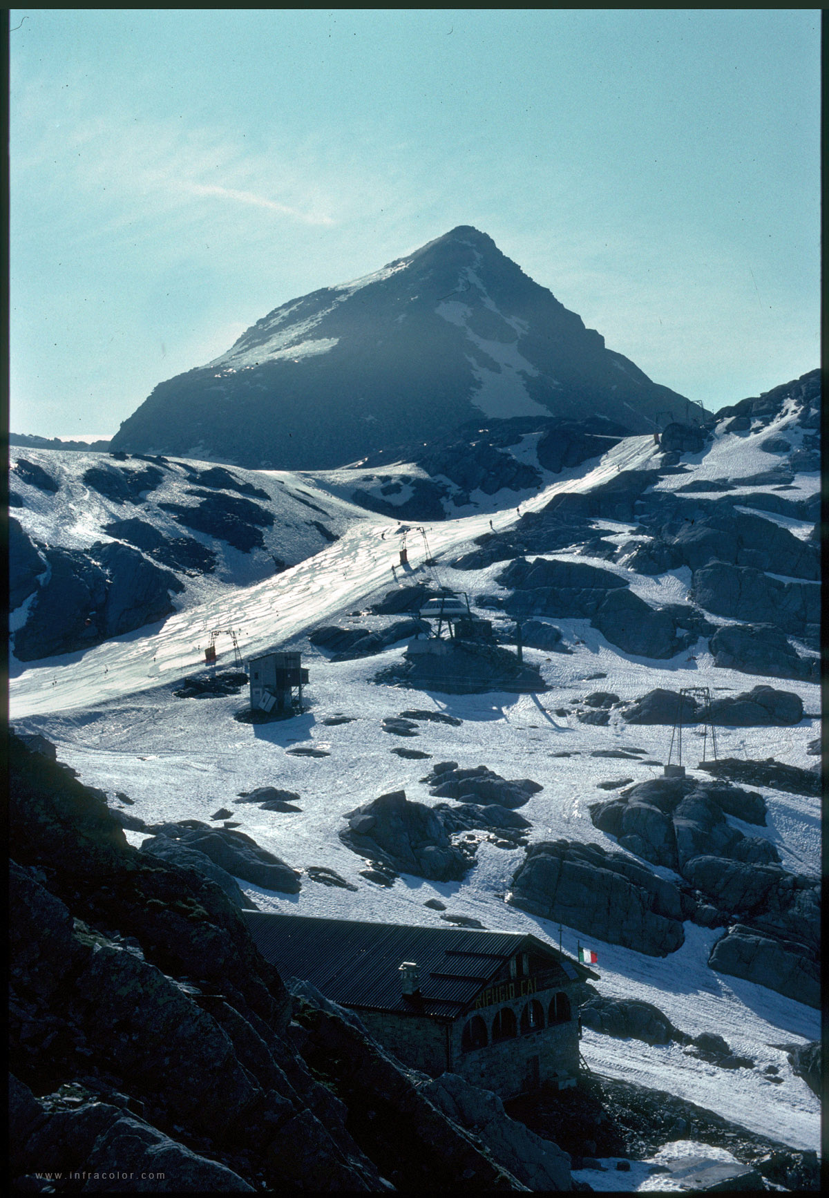
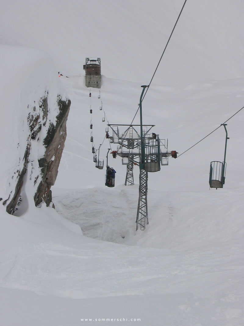
In the last years of summer skiing and after stopped Alagna and the Punta Indren had a cometelike riseup to one of the best-known freerideareas in Italy (Impression in the end) and home to the great "Balma-Basket-Lift" with a station that looked like a bunker, but this ended suddenly after the Alagna ski resort ran out of money and was overtaken by the nearby skiarea of Gresonney. (Now Alagna can just be seen als another link to the skiing area of Gresonney)

Interesting Mountains: Name Height - Length - Altitude Difference - Average Increase (in %) - Category

1a tappa: Belvedere 1764m - 31,7km - 1521hm - 4,8% - Cat. 1
1a tappa: Lago Robej 2640m - 21,1km - 1763m - 8,4% - Cat. HC
1a tappa: Punta Naret 2558m - 6,1km - 666hm - 10,8% - Cat. 2
1a tappa: San Carlo 984m - 10,8km - 517hm - 4,8% - Cat. 3

2a tappa: Passo del Sempione 2091m - 35,4km - 1738hm - 4,9% - Cat. 1
2a tappa: Monte Moro 2757m - 34,9km - 2057hm - 5,9% - Cat. HC

3a tappa: Viar Päss I 2160m - 26,7km - 1533hm - 5,7% - Cat. 1
3a tappa: Viar Päss II 2478m - 13,7km - 1128hm - 8,2% - Cat. 1
3a tappa: Viar Päss III 2109m - 15,0km - 955hm - 6,4% - Cat. 2
3a tappa: Viar Päss IV 2430m - 12,0km - 882hm - 7,4% - Cat. 2

4a tappa: Grand St.Bernard 2479m - 25,8km - 1604hm - 6,2% - Cat. 1
4a tappa: Colle di Joux 1652m - 17,1km - 1125hm - 6,6% - Cat. 1
4a tappa: Colle di Bettaforca 2677m - 7,6km - 1074hm - 14,0% - Cat. 1
4a tappa: Bontadini 3282m - 36,0km - 2751hm - 7,7% - Cat. HC

5a tappa: Grenzgletscher 3984m - 22,7km - 2364hm - 10,4% - Cat. HC

Some Impressions:

Image
This has once been the Gondola Station of Rossareccio in front some rests of an T-Lift

Image
Monte Moro 2898m - Last time summerskiing was once possible on the shortest of the italian T-Bars in 2004.

Image
What made Alagna famous - The Basket lift and the unbelievable freeriding possibilities

Image
The stage ends not directly by the gondola on Punta Indren but left outside of the picture

Image
Bontadini - The highest but surely not the nicest place to reach in the alps by car


    Stages 2 to 5 to come soon :)

    Post Reply

    Who is online

    Users browsing this forum: No registered users and 15 guests