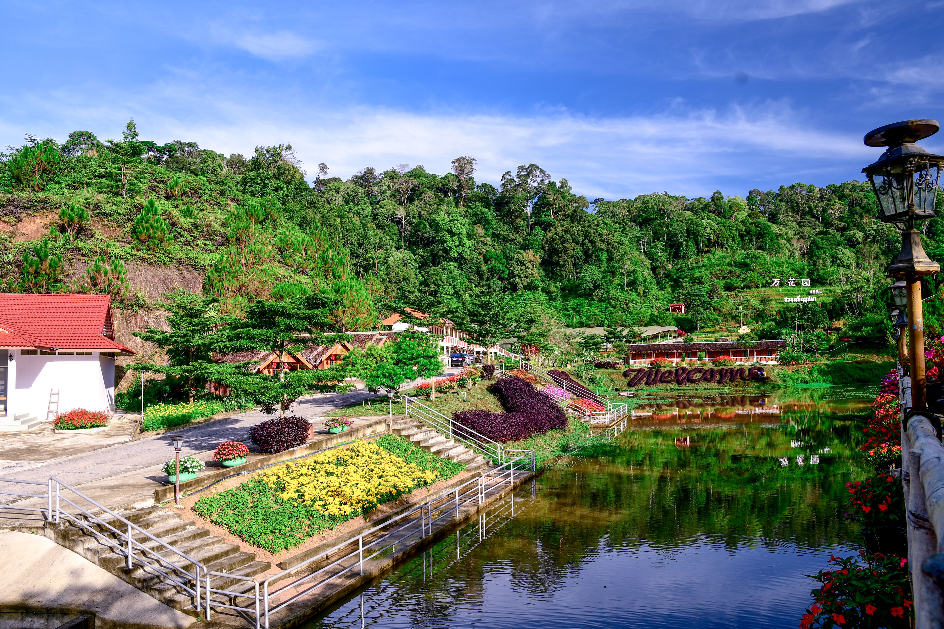
Tour of Vietnam 2024
Introduction
The legend says that the Vietnamese People are the children of "Au Co" a mountain goddess and "Lac Long Quan" the master of dragons.
They had 100 Children together but afterwards it had to be stated that the relationship didnt work together, so "Au Co" went to the mountains with 50 of the Children, while the 50 others followed their father to the coast.
Later on one of the Children followed its Father as king and he was the first one of the "Hung-Dynasty" that reigned the Country from 2879 B.C. until 258 B.C., which was separated into 15 districts at that time.
Between this time and the end of the first millenium Vietnam was mostly a chinese prefecture, while in the year 938 the now so called "An Nan - Peaceful South" took use of the weakness of the chinese Tang-Dynasty and founded the first Vietnamese state.
While in the next 600 years the reign expanded it also erodated so that families of Traders became more and more powerful with help of european especially French support.
This all ended up in 1858 when Vietnam became a French Colony. Before the 2nd world war Vietnam became then under japanese Control and in the Indochina-War French and japanese fought for the might. Also in this time a Person called "Ho-Chi-Minh" founded some oppositional resistance Groups that would neither accept japanese nor French rule over Vietnam.
And then the rest is history … the one that ended with the biggest war loss in the history of the USA, where they tried to avoid a communistic Ruling of vietnam and the fall of Saigon in 1975 now called Ho-Chi-Minh-City.
Nowadays Vietnam is reunited and still a communistic one Party state. But its also known for a Wonderful Landscape … People that are open and heartful … great Cuisine and timeless Architecture (including the French impressions). It has also some Curiositys (just Google Hanoi Train Street

) Oh and bycycles are one of the favoured Transport Systems there. So that is the perfect reason to introduce you to the TOUR OF VIETNAM 2024.
General Information
9 riders per team
13 Stages + 1 Rest Day in total split into:
5 Flat Stages
5 Middle Mountain Stages
2 H.C. Mountain Stages
1 Individual Time Trial
2.081 km in total
160 km per stage (170 km excluding ITT)
27900 hm in total
2146 hm per stage (2289 hm excluding ITT)
99 min average riding time (104 min excluding ITT)
Stage presentation will be the following:
Stage Number – Stage start to stage finish – Stage Type – Stage length – Stage ascent – Mintact at km: xxx – Stage duration: xxx min
Rules for IS and GPM:
2 intermediate sprints per stage valued with 6-4-2 points for the first 3 riders and 3,2,1 seconds
The GPM will be categorized and presented as follows:
The start of a climb will normally the first 3+ km as the last 3+ km will be ist end, but there may be exceptions like a climb starting with lower percentages directly after a downhill with no flat part in it.
Cat. 4 - >250hm or presenters choice - Name - KM - Length - HM - average steepness
Cat. 3 - >500hm or over 300hm and 5% - Name - KM - Length - HM - average steepness
Cat. 2 - >750hm or over 500hm and 5% - Name - KM - Length - HM - average steepness - Steepest KM
Cat. 1 - >1000hm or over 700hm and 5% - Name - KM - Length - HM - average steepness - Last 10km and Steepest km
HC - Overall hardest climb - Name - KM - Length - HM - average steepness - Complete Climb profile and steepest KM
If a climb has special characteristics but does not fit certain criteria its up to the designer to choose another category.
It will be then explained in the stages description.
Rules for stage finishes:
Points according to the usual C4F regulations
10,6,4 second on all stages except ITT in the finish!
Tour Overview
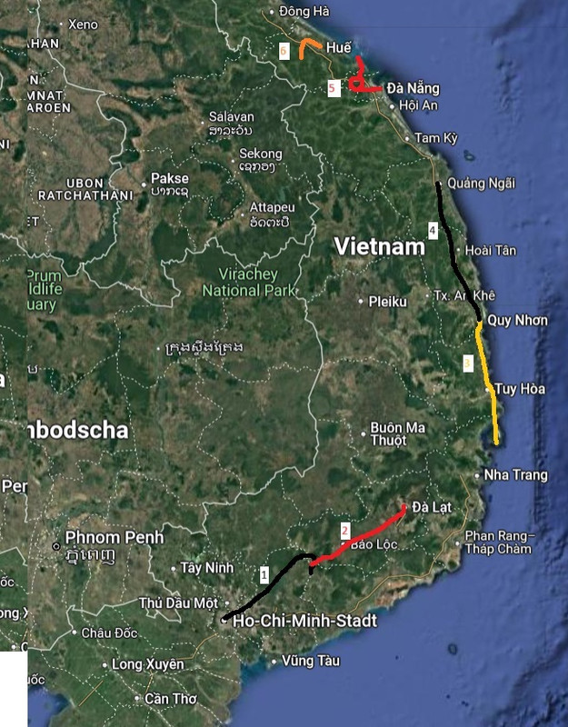
^ Part 1 ^
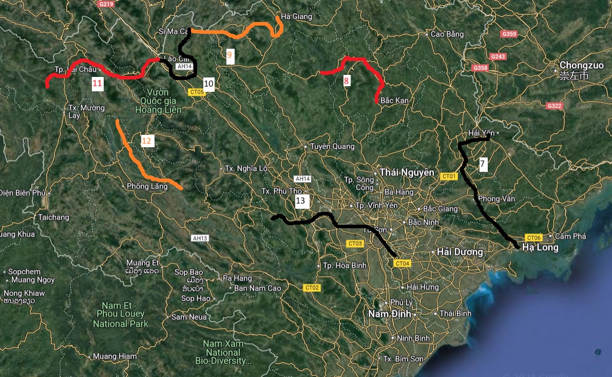
^ Part 2 ^
Stage 1 – Ho-Chi-Minh-City to Duc Phu – Flat Stage - 193 km – 880 hm – Mintact at KM: 157 – Stage duration: 115 min


^ Ho-Chi-Minh-City ^
"Bac Ho" - Uncle Ho how he was called for some people indeed IS the state of Vietnam. When he brought in 1919 a paper to Versailles where he denounced French colonialism and its exceeding violence against Vietnamese people in front of US-President Wilson he had to leave the Country beyond this. But when he came back later he and his Opposition Forces laid the Ground of on what Vietnam is built today. When the war against US ended in 1975 it was even decided to rename the former City of Saigon (biggest City in Vietnam) after Ho-Chi-Minh who died in 1969. And thats why we start our tour in Ho-Chi-Minh-City.
Leaving the Mekongdelta out because of the extremely wet Climate the riders leave the City to the east along the main road (National Highway 1) passing mostly rural places in the Trang Bom district. The first Sprint of the tour takes place in the districts main City also named Trang Bom.
After the first 90km beeing Pretty much eastwards the route the takes a sweep to the North towards the Tri an Lake which is artificial and can take up to 2,7 Billion m3 of water. After 110km the lake is reached at Phu Ngoc with the second and last sprint of the day.
The last bigger place on the way is Ma Da Guoi where at km 157 also the mintact starts because of a combination of 5-4 which could sieb the Sprinters. The Question is if their concurrence already siebs here or waits for their second Chance at 173 (or wont they try at all?).
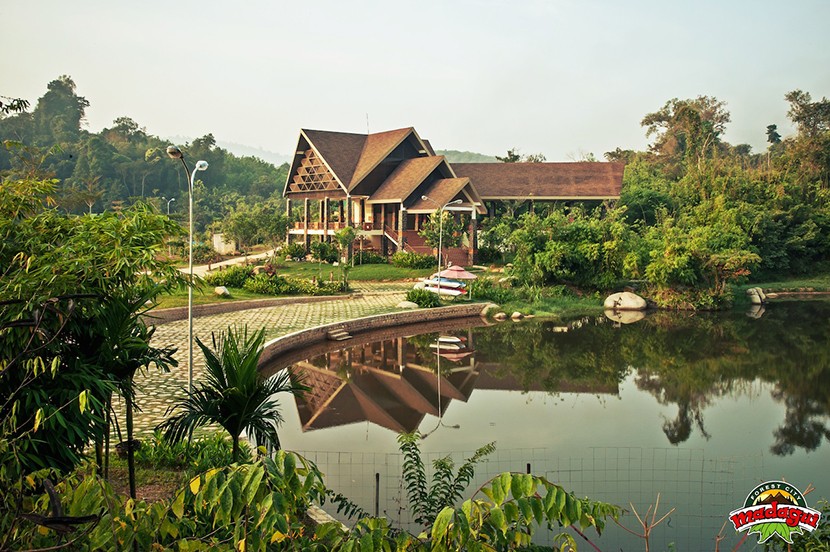
^ Ma da Guoi ^
The route then continues Pretty flattish but km 189-192 is a Downhill where Maybe some unattentive sprintteams could be in Trouble.
Then the race Ends with a single flat km at Duc Phu a Little Village.
Intermediate Sprints:
KM 54 – Trang Bom
KM 110 – Phu Ngoc
GPM:
None
Last 10 km: 2, 1, 1, 1, 1, -6, -6, -5, -1, 0
Stage 2 – Da M'Ri to Da Lat – Middle Mountain Stage - 184 km – 2740 hm – Mintact at KM: 146 – Stage duration: 111 min

Da Lat is today called the "City of everlasting spring" and also "Little Paris". Both of this names would not have been found if a co-worker of Louis Pasteur, Dr. Alexandre Yersin wouldnt have been the first european to visit the city. 20 years after the french colonialists officially founded the city that then became a popular spa for the upper class of Vietnam which was, who guesses? Mostly european. Da Lat was pretty important in the Vietnam war as it hosted the only vietnamese nuclear reactor. Still it was pretty much untroubled by the destructions of war which led to the fact, that you can visit many examples of colonial architecture and enjoy the beautiful surrounding of lakes, waterfalls and woods. And thats why stage 2 finishes there.
The start is still in the lowlands in Da M'Ri but nearly directly after the start the first climb of the tour will start and lead the riders up into the central highlands. Even if this unnamed climb after 14km should not be a big effort for the riders the fight for the mountain jersey is up now! Now the Highlands are reached and the first bigger City on the way is Bao Loc which is famous for ist tea.
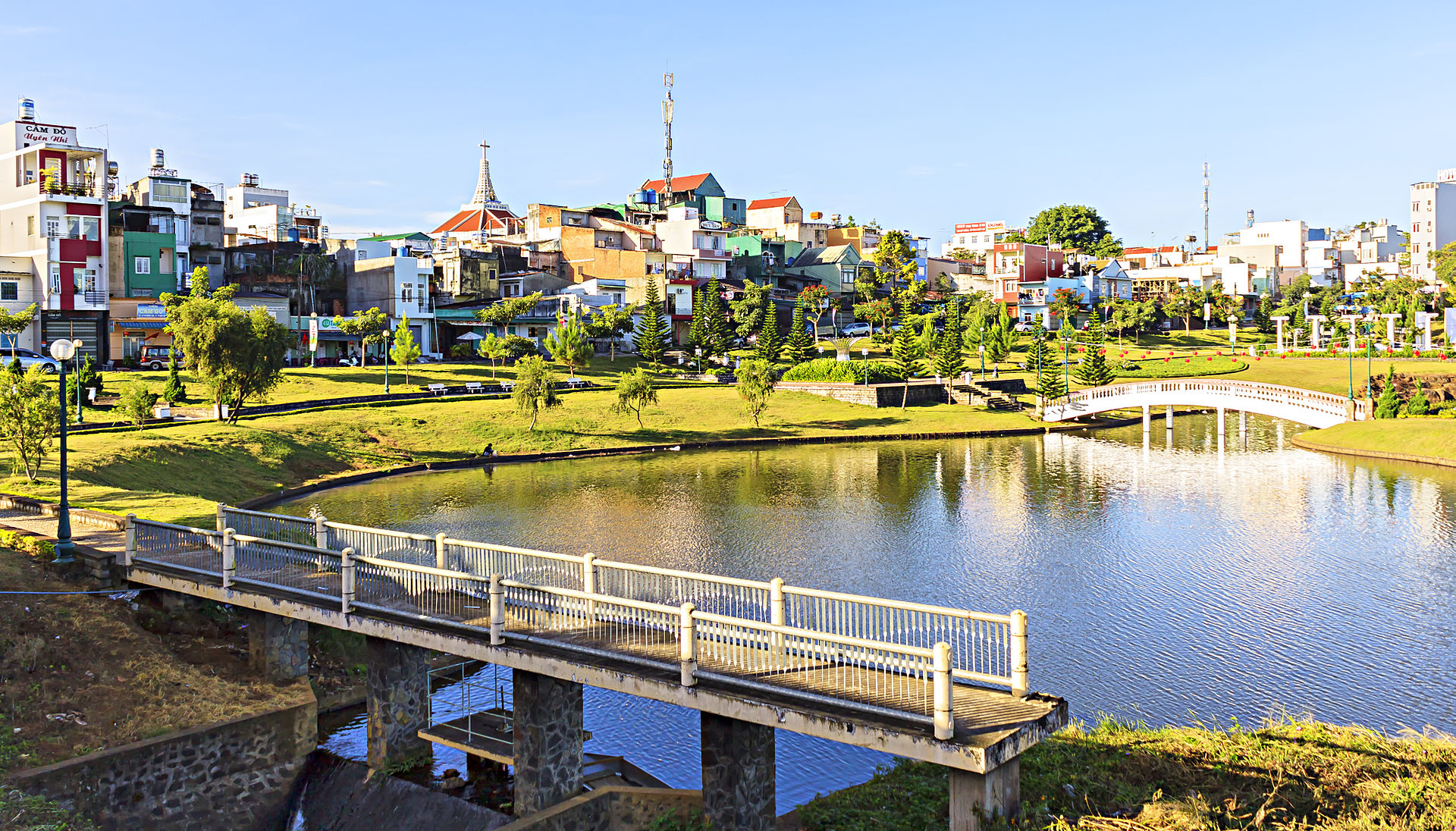
^ Bao Loc ^
This is also a good reason for some regenerative sprint action! From there the route takes a turn into the east reaching the Di Linh district but not heading to the capital but shortly before taking a 180° turn to the west. Until roughly half of the route the race stays flat before it goes down into the valley of Song Dong Nai river, still following main route 725 after the Downhill into the rivers valley the uphill has to be taken again ending near the village of Tan Hop. Also there is another unnamed extremely steep km shortly after.
Another flat part on main roads is following to Dinh Van where riders compete for the second sprint and also leave the main roads, which means also an introduction for the final harder part of the day. It starts with the Little climb up to Nam Ha which also leads us into the Mintact. After the little hill the next 20km are nearly flat until Ta Nung where the riders reach again the main road. But the main road is the harder one so the way up to Da Lat will finally decide the stage. But Attention ist just one siebkm followed by some uphill and then a few flat km until the finish!
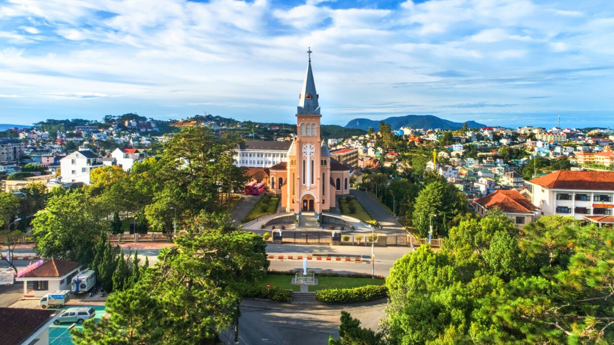
^ Da Lat ^
Intermediate Sprints:
KM 30 – Bao Loc
KM 142 – Dinh Van
GPM:
Cat. 2 - Unnamed - KM 14 - 10 km - 540 hm - 5,4% - Max. 7%
Cat. 4 - Tan Hop - KM 107 - 6 km - 290 hm - 4,8%
Cat. 4 - Unnamed - KM 113 - 1 km - 120 hm - 12%
Cat. 4 - Nam Ha - KM 149 - 4 km - 220 hm - 5,5%
Cat. 3 - Da Lat - KM 177 - 9 km - 350 hm - 3,9%
Last 10 km: 4, 3, 4, 1, -1, -3, 1, 0, 1, 0
Stage 3 – Hon Son to Quy Nhon – Flat Stage - 171 km – 640 hm – Mintact at KM: 133 – Stage duration: 103 min

The Quy Nhon Region has been residence to the Kingdom of the "Chams" which had been a muslimic tribe of rice Farmers in the Tradition of the former well known Champa-kingdom. From the 11th century until the 15th century the so called "Cha-Ban-Citadelle" which is near to the City was their seat. But 1471 the reign ended because of occupation through the Vietnamese side. From that time the city grew especially through fishing and farming. And thats why todays stage ends there.
But the start is - after a little overnight transfer - in Hon-Son-Island which is very well known as a tropical and pretty untouched paradise. From there the riders will head directly northwards and leave the Island via its bay.

^ Hon Son Bay ^
After passing the bay the race will leave the coast for the only time of todays race heading up to the well known sightseeing point Deo Ca that contains some uphill riding but it is not categorized.
The race comes back to the coast at Tuy Hoa a bigger city, where riders will also pass a former Castle of the Champa dynasty. But more important for them will be the sprint.
From now on the road will always follow the coast, but interestingly also coast roads are not always totally flat in Vietnam, so before reaching the second sprint in Song Cau there is a possible km to sieb weak sprinters away. And only a few km afterwards the only categorized climb of the day might bring the decision between sprinters and hillsprinters already.
But Attention - on the road to the finish there is another very little hill. It shouldnt be enough to sieb, but it could be enough for a classics group to attack … very maybe at least. Then the riders left can sprint it out on the harbour and eat some fish that makes them powerful enough for the next day!
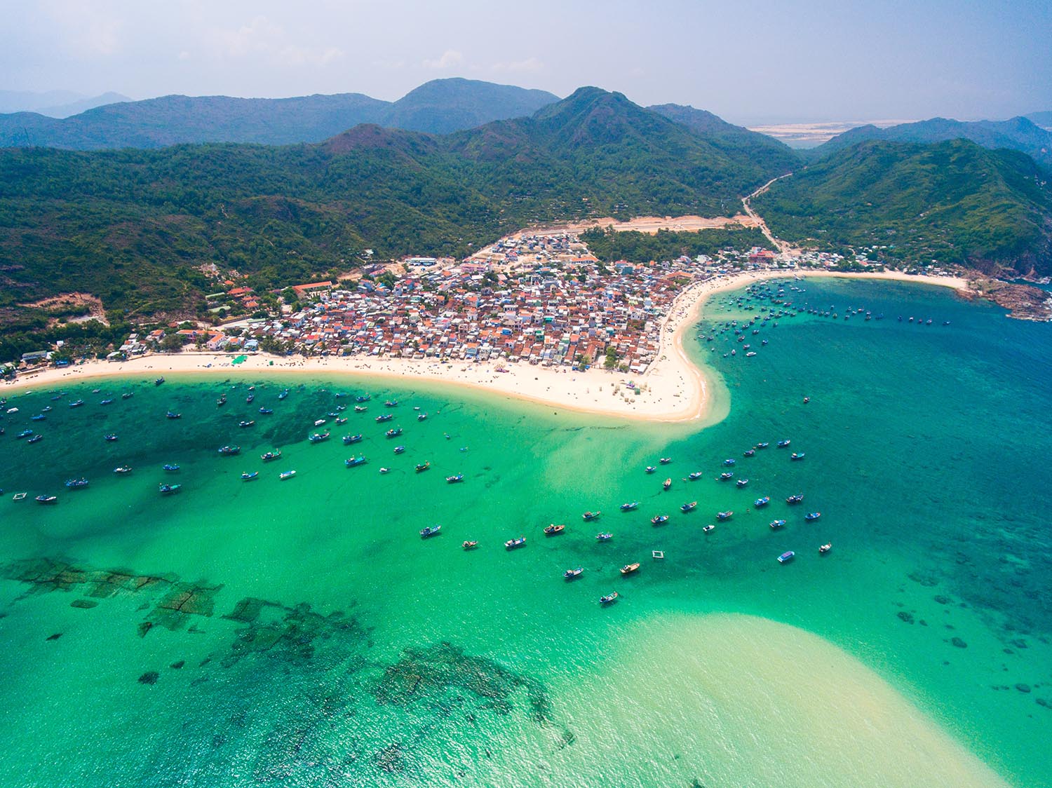
^ Quy Nhon ^
Intermediate Sprints:
KM 73 – Tuy Hoa
KM 125 – Song Cau
GPM:
Cat. 4 - Unnamed - KM 134 - 2 km - 120 hm - 6,0%
Last 10 km: 4, 3, 4, 1, -1, -3, 1, 0, 1, 0
Stage 4 – Quy Nhon to Quang Ngai – Flat Stage - 195 km – 770 hm – Mintact at KM: 180 – Stage duration: 105 min

Around Quang Ngai lies the small Village of Son My. Seymour Hersh an american journalist brought out an research that one of the biggest massacres in vietnam war was in Son My when US-Army soldiers killed over 500 people that where not guilty of any action against the us were killed. Not only that Mr. Hersh won the Pulitzer Price in 1970 it was also a main point of changing the thoughts of american people about the war. And thats why our stage ends there.
The start is in Quy Nhon where the yesterdays stage ended. The road ist mostly heading towards the North not exactly on the coast but parallel to it passing mostly small villages of which ones Long Khanh on the Riverside of Song Ang Lao river might be the most important one so thats also the first sprint of the day just after over more of half the race.
Afterwards the route still continues northwards but because it is not directly at the coast the Nuoc Ten pass awaits riders with Kind of a crazy profile that could hurt Sprinters very much.
After that follows a Downhill to Duc Pho were the US-Army had one of their biggest basecamps … but at least ist also the Point where the Beautiful coast is reached.
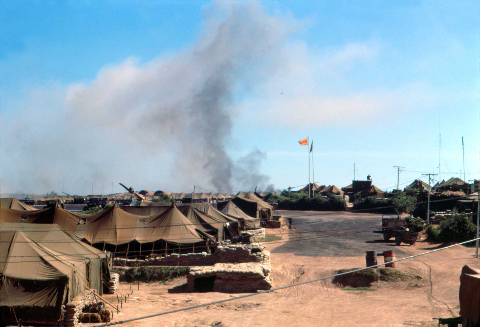
^ Duc Pho Base Camp ^
From there ist just a very Long flat road alongst the coast where the Sprinters will try to catch up again until the City of Quang Ngai. Luckily today the wounds of war have Maybe not forgotten but at least healed a bit and so it is this what the riders see on their way to the finish:

^ Quang Ngai Coast Line ^
Intermediate Sprints:
KM 98 – Long Khanh
KM 147 – Duc Pho
GPM:
Cat. 3 - Nuoc Ten - KM 128 - 7 km - 430 hm - 6,1%
Last 10 km: 0, 0, 0, 0, 0, 0, 0, 0, 0, 0
Stage 5 – Da Nang to Lang Co – Middle Mountain Stage - 139 km – 3770 hm – Mintact at KM: 96 – Stage duration: 91 min

Da Nang with its around 1 million inhabitants is not only vietnams 5th biggest city, but it has also a changeful history. While french colonialism known as Tourane and an important port in the vietnam war it became a vital base to the US marines. Nowadays its again a very important trade port for vietnams export. Besides that it lies near the meteorological divide between north and south vietnam which we are leaving today. And thats why stage 5 starts there.

^ Da Nang ^
The stage itself is pretty easily told. Leaving Da Nang to the north the riders follow the coastline to Lang Co which is only 50km away. Lang Co is especially known for its beautiful white sand beach that is several kilometres long.
But dont worry its not just about that. Already after 11 km the riders will take part in the first sprint that is held in Lieng Cheu in the outer parts of Da Nang. But then the action in this shortest (besides ITT) but still one of the hardest and most exciting stages of this tour starts. The mythical "Hai-Van-Pass" better known as "pass in the clouds" is awaiting. This pass is the last outpost of the Truong-Son-mountains.
And while many people will know the train over it and the national route 1 part of the Asian Highway system might still be known to some, only a few know that also the old route 1 still exists and makes it possible to go for a round route. And this route is not too easy cause the old street leads more towards the coastline with a steep downhill and then a steep uphill back again to the real pass.
So starting from KM 19 with a pretty light incline the pass will be taken the first time. Afterwards its 10 hard rounds including a 10-7 combination, before the last 13km lead the riders down to Lang Co with also another sprint only a few km from the finish.
The question here will be if some classics team will be found that is willing to really control this or if some brave group will find itself that is willing to attack maybe even the gc contenders. Stay tuned!

^ Lang Co Beach with the Hai-Van-Pass behind ^
Intermediate Sprints:
KM 11 – Lieng Chieu
KM 136 – Lang Co
GPM:
Cat. 3 - Hai-Van (1st) - KM 27 - 9 km - 450 hm - 5,0%
Cat. 3 - Hai-Van (2nd) - KM 36,45,54,63,72,81,90,99,108,117,126 - 4 km - 300 hm - 7,5%
Last 10 km: -6, -6, -7, -5, -3, -5, -5, -2, -1, 0, 0
Stage 6 – Hue to Binh Dien Lake – Time Trial - 44 km – 430 hm – Mintact at KM: 1 – Stage duration: 44 min

Hue the old emperors seat of vietnam with its forbidden city can be somehow called the "Beijing" of vietnam. Lying on the bays of the Huong Gian also called parfume river the city with its 350.000 inhabitants has been the capitol of vietnam from 1802 to 1945. While vietnam war there had been big problems between the buddhistic traditionalists in Hue and the catholic (south vietnam) dictators Diem regime. Nowadays Hue lying pretty much in the middle of the country is a melting pot for culture and also very oftenly visited by tourists due to its forbidden city. And thats why its a perfect place to start the last stage before the rest day that is an ITT.

^ The imperial citadel of hue ^
The stage starts directly in the center of Hue leaving the city to the north on flat roads until it sweeps to the south where the only difficulty of the day (besides the stage beeing a long ITT) waits when riders pass the roads up to Ho Huon Dien lake which is used for hydroelectricity. Only a short downhill follows as the roads then continues absolutely flat again until the last 3km where the riders again ride upwards to another hydroelectric lake this time the Binh Dien Lake.

^ Binh Dien Lake ^
Intermediate Sprints:
None
GPM:
Cat. 4 - Song Bo - KM 25 - 6 km - 260 hm - 4,3%
Last 10 km: 0, -1, 0, 0, 0, 0, 0, 4, 5, 4
REST DAY - Hue to Ha Long
After this riders will be brought back to Hue where they can use the night to recover and maybe take also the guided visit to the forbidden city on the next day before in the afternoon the riders will be brought far into the north to Ha Long, where the second (and harder) week of the tour is commencing!
Stage 7 – Ha-Long Bay to Lang Som – Middle Mountain Stage - 200 km – 2250 hm – Mintact at KM: 154 - Stage duration: 123 min

The Ha-Long bay also called "bay of the diving dragon" (compared to the "rising dragon" where the tour will end) is an extremely pittoresque peace of nature that has been declared a world heritage in 1994. The rocks there (nearly 2000 due to official declarement) rise over hundreds of meters out of the water of the bay.
A Legend says that after vietnam was founded invaders tried to occupy the country by ships, so the God Ngoc Hoang send the dragonmother and her children to help the vietnamese tribe. They spit out many jewels which became rocks that built a citadel in and around the bay. After the invaders were beaten the dragons saw that the tribe was very diligent and that people helped each other. So the dragons didnt go back to the sky but stayed on earth. The dragonmother decided that the Ha-Long Bay should be her place to preserve "Dai Viet" (Great-Vietnam) for ever.
So what a great place to start the second part of the tour.

^ Ha-Long Bay ^
Riders should all be powerful enough again after the rest day so that is a good reason for starting with a pretty long and not too easy stage leading the riders north by northeast, passing the small village of Son Duong where sprinters can fight for points before the first challenges await.
The roads become more and more hilly and after 49 km the first real threat is reached with "Tinh Quang Ninh" but still only a little prequel to the rest of the stage and the tour.
The road keeps it direction then to the village of An Chau with first some downhill km before directly before reaching the village another short climb keep riders awake and could make the fight for sprint points interesting that will be fought of in Bien Dong only a little afterwards.
The next 20km are still a little hilly with a 6 and a 5 in it, but as the next real hill is just reached at km 138 its pretty likely that the race keeps calm until there. Then the road heads down into the Dong Mo valley with the samely named city. But the road leaves the valley after only a few km again and Lang Som will not be reached by the national route 1 (which ends there) but through the hills surrounding the valley, so it could become some pretty hot fight for the win as none of this hills itself is very hard but there are some directly after another that should make for some action nearly the chinese boarder after only a little downhill behind the last climb of the day.

^ Lang Som by night ^
Intermediate Sprints:
KM 19 - Son Duong
KM 90 - Bien Dong
GPM:
Cat. 4 - Tinh Quang Ninh - KM 49 - 8 km - 360 hm - 4,5%
Cat. 4 - Unnamed - KM 72 - 3 km - 200 hm - 6,6%
Cat. 4 - Unnamed - KM 138 - 3 km - 130 hm - 4,3%
Cat. 3 - Cao Loc - KM 158 - 6 km - 330 hm - 5,5%
Cat. 4 - Unnamed - KM 181 - 5 km - 270 hm - 5,4%
Cat. 4 - Unnamed - KM 192 - 4 km - 280 hm - 7,0%
Last 10 km: 7, 5, -5, -3, -3, -2, 1, 0, -1, 0
Stage 8 – Bac Can to Khuoi Phin – Mountain Stage - 165 km – 3510 hm – Mintact at KM: 121 - Stage duration: 105 min

Bac Can has originally been founded as a fortress for the troups of the Nguyen dynasty in the 1880s. More importantly the city later became one of the first headquarters of the Viet Minh in their war against the french colonialists. When general Valluy surrounded the city and tried to invade it Ho Chi Minh and his fellow Giap could only get away by hiding theirselves in earthholes.
Today the province just 160km from Hanoi is very well known as a nature reserve with mountains, many rivers and natural lakes and much green environment so its a perfect place to start the first clash of the mountain riders.
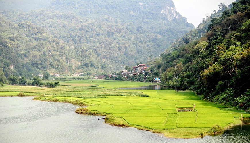
^ The Bac Can nature reserve ^
After yesterdays stage the riders were transferred some km to the east where they start early in the morning onto a hilly journey to the north. The first 45km are pretty much through uninhabited land on narrow but still asphalted streets where they meet some short but steep hills (of which ones only the first is categorized), before civilization gets them back at Na Phac a little village with the first IS of the day.
The next around 40 km riders follow the national road alongside the Song Ha Hieu river before they leave the main road shortly after passing Cho Ra where the second sprint of the day will happen.
Now the roads become steeper and the Khau But pass is the first of some steep inclines directly following each other with the Na Slien that is much harder as second one.
After it follows a longer downhill down into the river valley again before the ride up to Ban Tang completes this hilly triple.
The riders then will return to the main road and continue on it until Ban Cho before they leave again into the wild and follow first the river valley on a more or less flat street before in the end they have to face the extremely steep final climb. A little special here is that there is that it starts steep then km 162 to 164 are hilly or even flat before the last km becomes extremely steep again so when will who attack?
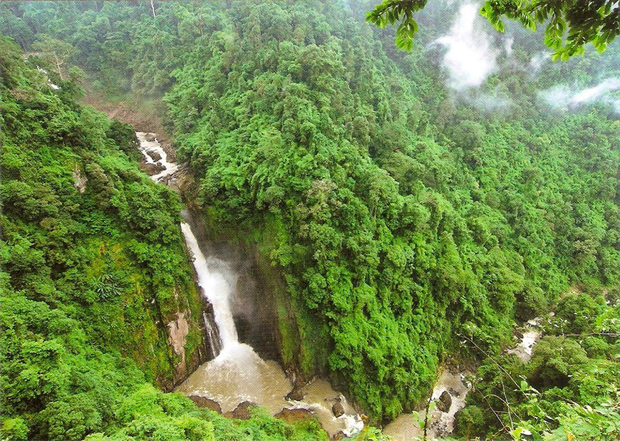
^ Wild nature on the way to Khuoi Phin ^
Intermediate Sprints:
KM 46 - Na Phac
KM 78 - Cho Ra
GPM:
Cat. 4 - Unnamed - KM 20 - 4 km - 270 hm - 6,8%
Cat. 3 - Khau But - KM 87 - 5 km - 380 hm - 7,6%
Cat. 1 - Na Slien - KM 106 - 14 km - 870 hm - 6,2% - 5, 4, 3, 5, 5, 5, 11, 12, 5, 4 (max. 12% at KM 104)
Cat. 3 - Ban Tang - KM 124 - 4 km - 370 hm - 9,3%
Cat. 1 - Khuoi Phin - KM 165 - 9 km - 720 hm - 8,0% - 9, 7, 12, 11, 13, 4, 7, 0, 9 (max. 13% at KM 161)
Last 10 km: 1, 9, 7, 12, 11, 13, 4, 7, 0, 9
Stage 9 – Vinh Quang to Si Ma Cai – Mountain Stage - 129 km – 4100 hm – Mintact at KM: 32 - Stage duration: 103 min

The original name of todays star means "nine stairs" what will tell people already that today its not a city were talking of but a mountain. 2.402m above sea level its the second highest point in vietnam to be reachable by street (indeed the asphalted parts reach 2300m so thats our top). The legend says that when french people invaded vietnam they wanted to use the mountain as an observation point and so they hired chinese workers making it possible to reach the top by 9 stone steps. While the August revolution the Viet Minh used this place for many revolutionary actions.
And thats a good reason that the Chieu Lau Thi pass will be passed on the kings stage of the tour.

^ Chieu Lau Thi ^
Starting from the city of Vinh Quang a rural commune in the far north of vietnam todays race will be absolutely full of action. And while beeing the king stage still if mountain riders want to win the tour they will most likely need to go for a suicidal attack today.
The reason is that just after leaving the city on the main road to the south the action begins. On a sharp 180 degrees turn the riders leave the main road and fight out the first sprint of the day and then climbing action is directly on.
The first step of the mountain top consists of a long 2 parts climb to the village of Quang Vinh (not the same that our starting point). 2 parts because it is more or less like 6km uphill, 3km flat, 6km uphill which in the end makes for a place some teams already might prepare action and where its also pretty sure that a grupetto will be formed.
While the next 8km give the teams time to regroup and maybe a last time think about how they want to ride this stage then it becomes crucial with the clearly hardest and longest climb of the hole tour. This one leads the riders up to over 2400 meters while the race just started down at around 500 meters above sealevel.
But it also could be dangerous because what follows after is by far not as hard as this one so most likely we will see either a gc try or some extremely hard controlling here.
The good thing for the riders is that long uphills are followed by long downhills - in this case its 23km down to the valley of the Song Chay river where riders also get back on the main road again and can relax for around 10 more km before the second hilly part starts.
Here the hardest part again is the beginning with an 12km long but not too steep hill leading the riders onto the plateau of Si Ma Cai.
From then on the last 40km are more or less hilly terrain which will make it hard to gain big time advantages as most riders should be somehow tired already.
The final decision will be taken in the final 10km as first a little downhill brings riders to the an valley and then the street rises up again before the final km into the city of Si Ma Cai are flat or slightly downhill.

^ Si Ma Cai district ^
Intermediate Sprints:
KM 6 - Vinh Quang
KM 112 - Lung Phing
GPM:
Cat. 1 - Unnamed - KM 23 - 15 km - 930 hm - 6,2% - 6, 1, -2, 1, 7, 5, 5, 14, 10, 6 (max. 14% at KM 21)
Cat. HC - Chieu Lau Thi - KM 44 - 13 km - 1320 hm - 10,2% - 7, 7, 11, 11, 12, 11, 11, 10, 12, 12, 10, 8, 10 (max. 12% at KM 36,40,41)
Cat. 1 - Unnamed - KM 90 - 12 km - 930 hm - 7,8% - 4, 4, 5, 9, 10, 10, 9, 8, 9, 10, 6, 9 (max. 10% at KM 83,84,88)
Cat. 4 - Unnamed - KM 97 - 2 km - 200 hm - 10%
Cat. 3 - Unnamed - KM 124 - 5 km - 330 hm - 5,5%
Last 10 km: 9, 5, 6, 9, 4, -5, -3, -4, -3, -1
Stage 10 – Si Ma Cai to Lao Cai – Flat Stage - 142 km – 1050 hm – Mintact at KM: 122 - Stage duration: 81 min

Lao Cai itself and its "sibling" Hekou on the chinese side both directly lie at the boarder between those states. While the city itself has neither very much of historical nor of todays importance it always has been extremely important to the Yunnan Railway which was built by the french and one of the oldest railways all over china.
While persons transport is more or less irrelevant on this railway its a vital transport way for big freights between Kunming in China and Hai Phong port in vietnam.
What a good reason for a finish.

^ Song Chay river ^
From yesterdays finish in Si Ma Cai the route will leave the mountains today so the first 15km uphill including a single 5 will be the only threat for the sprinters today. After having finished the mountain the riders will follow a plateau before they have a long downhill to the banks of Song Chay river where they are nearly back so sealevel again.
Next a wide slope takes the riders away from Lao Cai into the eastern direction before the road turns at Pho Lu from where the riders (after sprinting for a first time this day) change direction back to the west and head on good streets towards Vi Ma with the second sprint of the day.
The road is completetely flat there so when after 142 km the riders will see the Lao Cai train station in front of them it is very likely that a sprinter will win it there.

^ Lao Cai train station ^
Intermediate Sprints:
KM 95 - Pho Lu
KM 115 - Vi Ma
GPM:
Cat. 3 - Unnamed - KM 15 - 15km - 520 hm - 3,5%
Last 10 km: 1, -1, 0, 0, 0, -1, 1, 1, -1, 0
Stage 11 – Lao Cai to Sin Ho – Middle Mountain Stage - 164 km - 4010 hm - Mintact at KM: 117 - Stage duration: 105 min

The Sin Ho plateau is luckily or unluckily not very well known by tourists. Its also called the rooftop of Lai Chau province where different fruits can be earned like pears and plums.
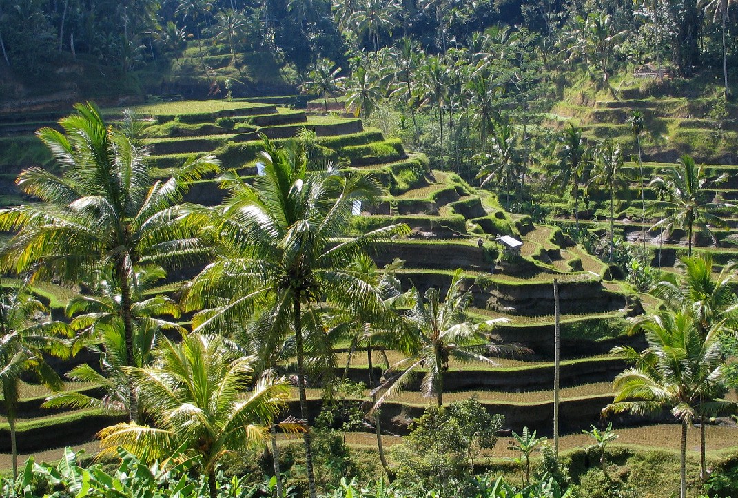
The yellow rice teraces surrounding it are even as beautiful as the the peaceful landscape is anyways. Also its a melting pot of at least 15 known tribes that live and work together.
So what a beautiful place for a hilly stage finish after the flat race yesterday.
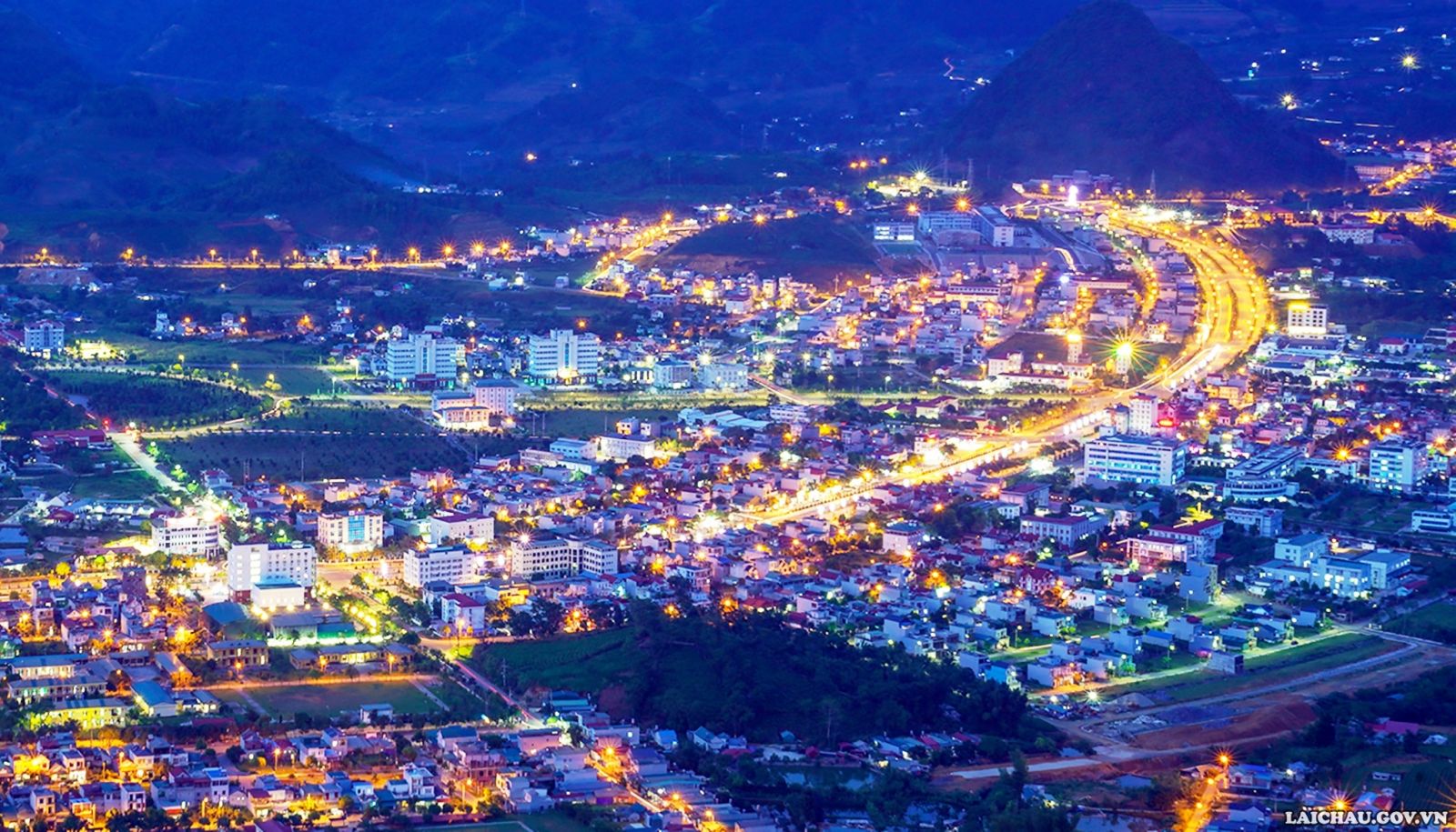
^ Lai Chau by night ^
Another day we start at Lao Cai. This time the riders take the logical way to the east from Lao Cai to the very vell known rice fields of Sa Pa which means again a long long uphill. The difference to some days before is that its not a steep thing but mostly a slow thing where most of the riders will most likely keep up the pace.
Now 30km of downhill are following into the village of Tam Duong with a little sneaky sprint. Directly then the Tac Thac Tinh pass with a waterfall to watch is on the way but still the real action should not be on as it is also not a very long nor steep climb with only a sneaky 7 in it.
While the field should become a little smaller after the hill the rest of the peloton goes into a downhill and takes the way to Lai Chau also called Muang Lay the province city with its around 40000 inhabitants and some sprint money on the way.
When the city is passed the Nui Ta Gia Khau pass is the second last difficulty of the day just around still 40km from the finish which is a bit steeper then the hill before and might leave a very reduced peloton on the way to the final.
A last downhill will make some riders regain power before the final will ask for very strong classics to keep it up on the way to the Sin Ho Plateau. Hope for a bit weaker riders could be that the last Siebkm is 8km from the finish and that the rest is more or less between slight uphill and downhill.
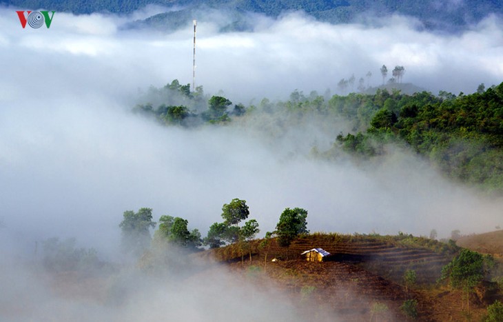
^ The Sin Ho Plateau
Intermediate Sprints:
KM 79 - Tam Duong
KM 107 - Lai Chau
GPM:
Cat. 1 - Sa Pa Rice Fields - KM 50 - 40 km - 1890 hm - 4,7% - 1, 0, 1, 1, 0, 5 ,2, 4, 9, 4 (Max. 9% at KM 49)
Cat. 3 - Tac Thac Tinh - KM 94 - 13 km - 590 hm - 4,5%
Cat. 3 - Nui Ta Gia Khau - KM 124 - 9 km - 510 hm - 5,7%
Cat. 4 - Unnamed - KM 142 - 4 km - 280 hm - 7,0%
Cat. 3 - Sin Ho - KM 159 - 9 km - 490 hm - 5,4 %
Last 10 km: 7, 2, 9, 3, 4, -1, 1, -2, -4, -2
Stage 12 – Muong Kim to Bac Yen – Middle Mountain Stage - 164 km - 2850 hm - Mintact at KM: 132 - Stage duration: 98 min

The Hui quang hydroelectric power plant is one of the biggest ones in Vietnam. With over 500 MW the 2016 finished power plant is pretty impressive. It is part of a longer group of hydroeletric plants that are able to bring power not only to the province of Lai Chau but also to Hanoi and therefor is very important in vietnam. Furthermore the bays of the lake have become a vital point less for tourists but for the people living nearby to get a bit of a holiday feeling in the surrounding landscape. Thats a good reason to ride alongside this lake on the second last stage.
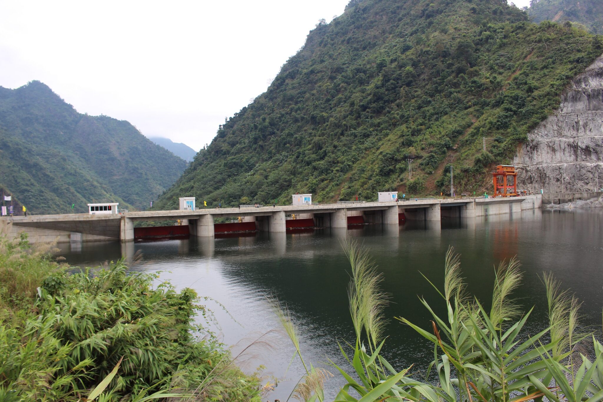
^ The plants dam ^
The start itself is in the village of Muong Kim just a few km away from the lake which is reached soon for the first sprint. Afterwards the road heads straight south alongside the lake for around 40km and is nearly totally flat, but when riders leave the lakeside the difficulties of the day begin.
While the first ramp is even uncategorized, the second one directly before reaching It Ong at km 70 (nearly half stage) is at least enough to become a Cat. 4 mountain.
It Ong itself is just a small but nice village where the second and last sprint of the day will be taken.
Now it becomes a bit tricky as the riverside is always in sight of the riders, but still the road takes the hilly surrounding so its just virtually up and down until the finish now. That means many small climbs in the categories 3 and 4 leave the chance to win many mountain points for the jersey decision and to split the field into parts and attack for the stagewin.
After KM 154 just 10km from the stage finish that enerving thing with 7 categorized small climbs in a just 70km is over when the riders reach Bac Yen, from where the road just slides down slowly into the finish just a few kms after the village.

^ Sunset in the hills over Bac Yen ^
Intermediate Sprints:
KM 17 - Hui Quang Lake
KM 70 - It Ong
GPM:
Cat. 4 - Unnamed - KM 60 - 4 km - 250 hm - 6,3%
Cat. 3 - Unnamed - KM 84 - 5 km - 360 hm - 7,2%
Cat. 4 - Unnamed - KM 92 - 2 km - 200 hm - 10,0%
Cat. 4 - Unnamed - KM 105 - 3 km - 230 hm - 7,7%
Cat. 4 - Unnamed - KM 117 - 4 km - 270 hm - 6,8%
Cat. 4 - Unnamed - KM 126 - 4 km - 230 hm - 5,8%
Cat. 3 - Unnamed - KM 136 - 5 km - 320 hm - 6,4%
Cat. 4 - Unnamed - KM 154 - 3 km - 220 hm - 7,1%
Last 10 km: -4, -3, -4, -4, -5, -5, -5, -4, -2, -1
Stage 13 – Phu Yen to Hanoi – Flat Stage - 191 km - 930 hm - Mintact at KM: 166 - Stage duration: 108 min

Hanoi "the city in between the rivers" is the vietnamese capital city. As the source of vietnamese democracy and peace movement the 8 million inhabitants city became the first city to become "city of peace" after UNESCO declarement in 1999. Before it has been sacrifice to mostly all conflicts in vietnamese history, from french conialism over Indochina war to Vietnam war. Nowadays the city directly lying at the red river is a touristical magnet and well known for its cultural and historical diversity. Even more if a city is one of peac its the best one to finish a tour in todays complicated world!
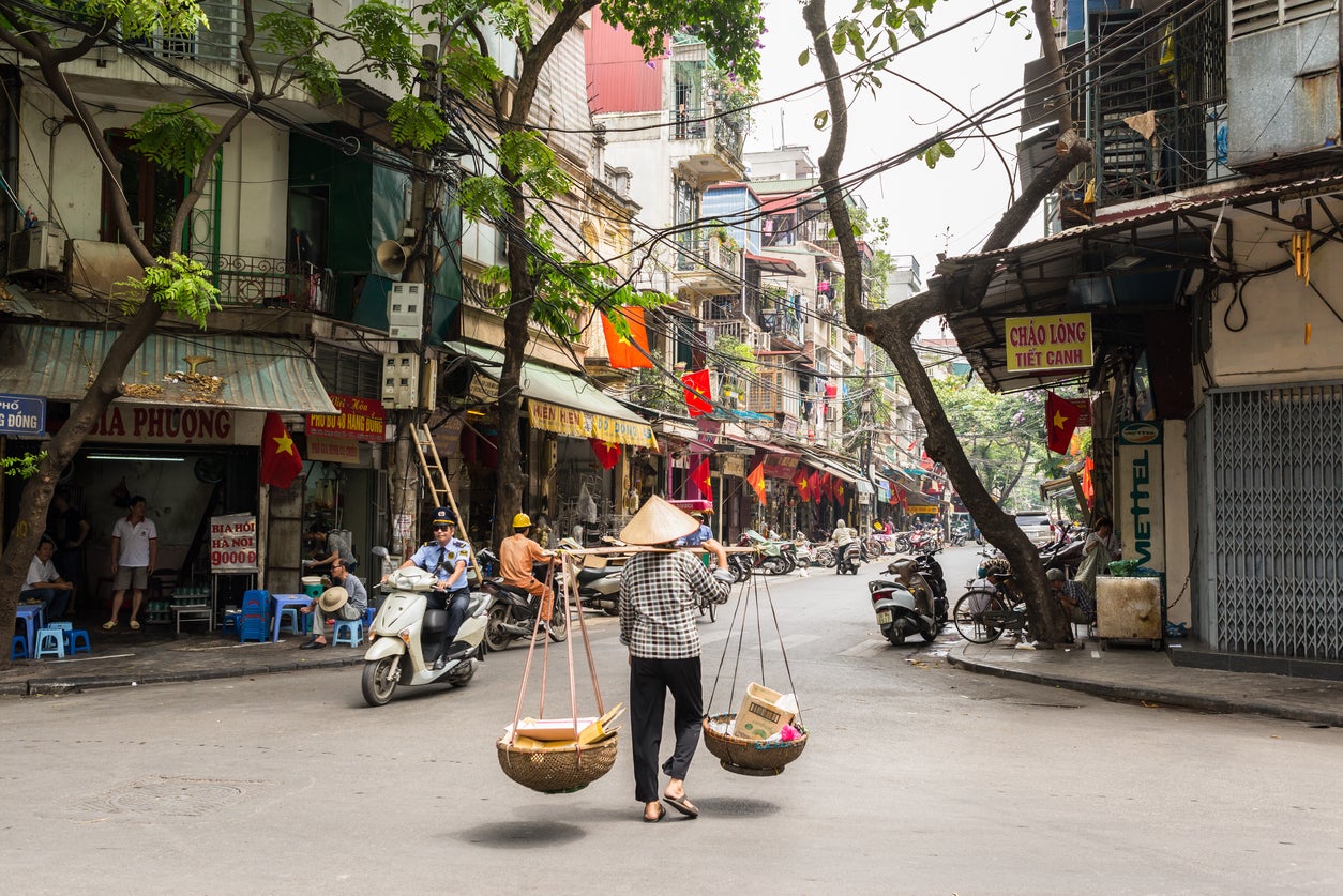
^ Typical scene in Hanoi ^
Before the ride ends in Hanoi the riders start in Vietnamese northern highlands. The first 20kms of this ride also consist of the 2 last uphill parts but both of them should very very likely with maximum a 4 degree uphill not scare even the weakest sprinters.
While the climb in Phu Yen district is at least categorized (and therefore the last one categorized of the hole tour) the followingvery slow up- and downhill is just the prelude to the tourfinish.
And then after 49km its really done. The riders have finished all of those difficulties they had to cope with and they start the long slight uphill that leads them more and more into the big valley of the red river which means also nearer to Hanoi.
Always on the eastern path the village of Thanh Son with the first sprint of the day might already make many of the riders that have been tired so much happy while the second sprint in Phuc Tho already in the outer district of Hanoi wakes up the sprinters.
And then? Then its finally done! A big sprint in Hanoi will finish this wonderful tour and all riders are invited to the way back to Ho-Chi-Minh-City in a special course of the Reunification Express!
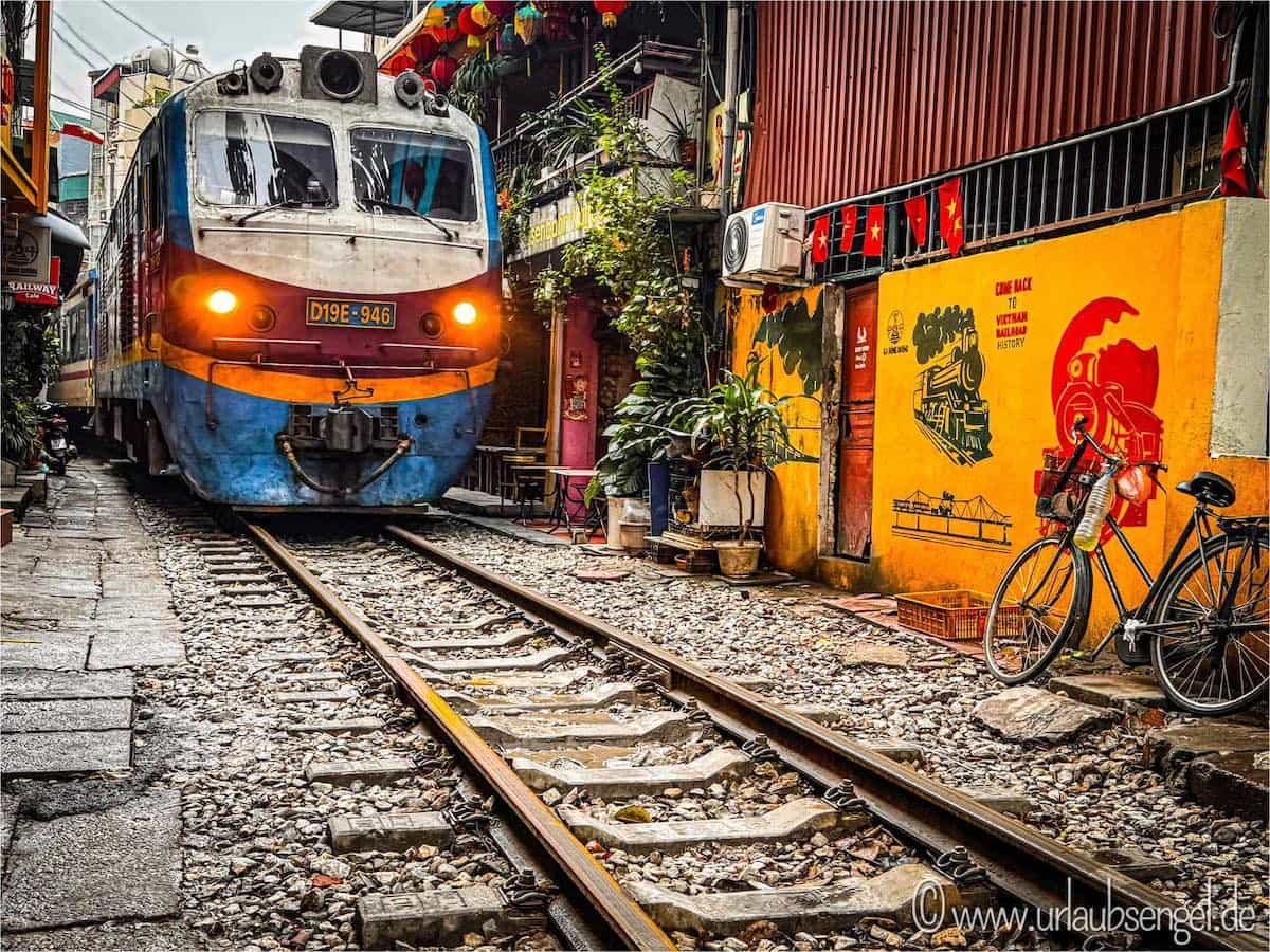
^ The "railway" street in Hanoi ^
Intermediate Sprints:
KM 106 - Than Son
KM 155 - Phuc Tho
GPM:
Cat. 4 - Phu Yen - KM 10 - 9 km - 290 hm - 3,2%
Last 10 km: 0, 0, 0, 0, 0, 1, 0, 0, 0, 0
*edit* Corrected last 10km of the ITT
